Resources

Reference material that supports the understanding of Hambledon’s history. This includes maps, timelines, and other supporting documents or collections.

Use this category for content that provides context or aids research rather than telling a specific story.

1897 – Ordnance Survey

1897 – Ordnance Survey

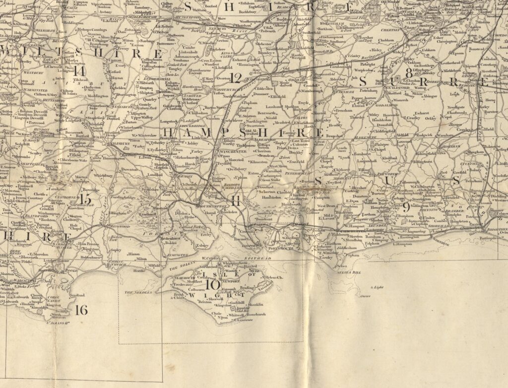
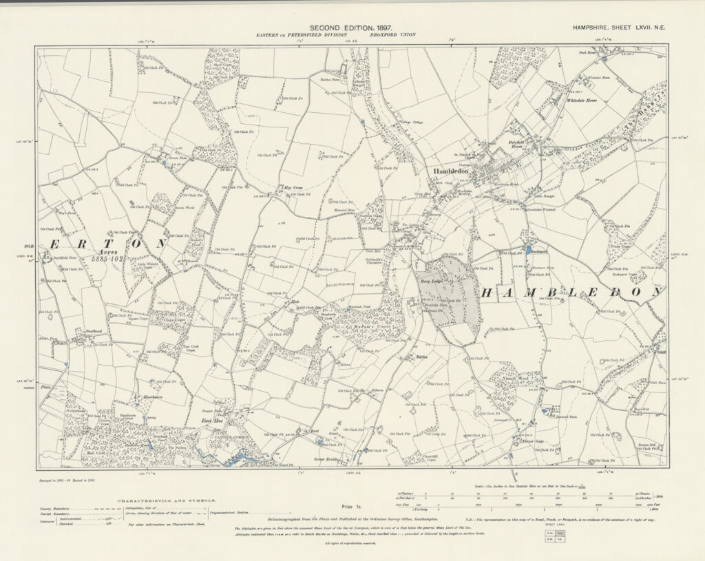
The Ordnance Survey Second Edition maps of Hampshire, published in 1897, were based on a systematic revision carried out in 1895. This revision updated the earlier First Edition large-scale surveys of the county, which had originally been conducted in the mid-nineteenth century. Rather than undertaking a completely new survey, the Ordnance Survey carried out field revision to record changes that had occurred in the intervening decades.
1842 – The Tithe Map

1842 – The Tithe Map

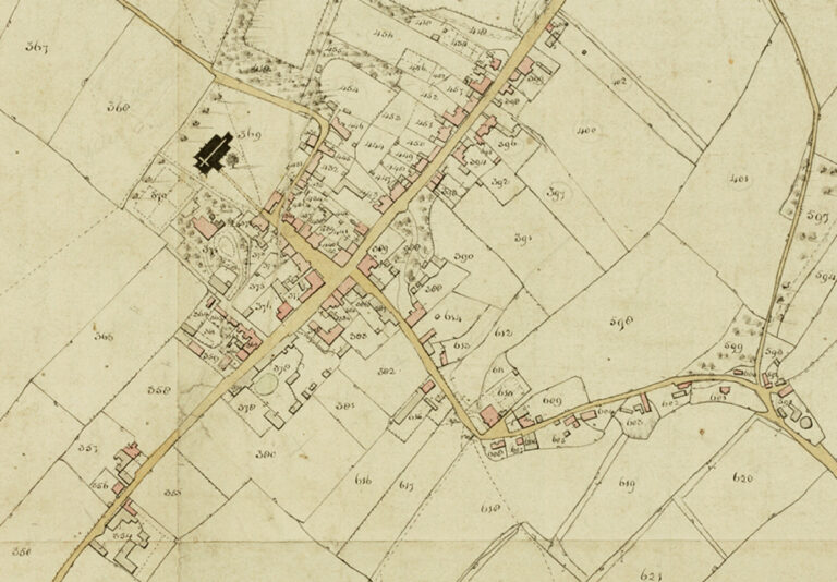
Tithe maps were produced following the Tithe Commutation Act of 1836, legislation passed to reform the long-established system by which a tenth of agricultural produce was paid to support the Church of England and, in some cases, other tithe owners. Traditionally, this payment had often been made in kind, meaning crops or livestock were delivered rather than money. The 1836 Act converted these payments into a fixed monetary charge known as a tithe rentcharge.

1826 – William Cobbett’s Rural Rides

1826 – William Cobbett

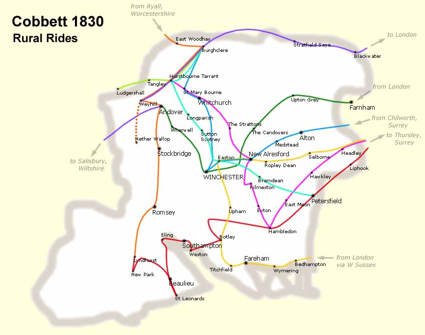
William Cobbett was born in 1763 at Farnham, Surrey, the son of a farm labourer. In early adulthood he enlisted as a foot soldier and served in North America between 1784 and 1791. After returning to England, he became a political writer, pamphleteer and publisher. In 1805 he settled at Botley in Hampshire, where he farmed and conducted much of his later writing.

1810 – Ordnance Survey’s Map of Hampshire

1810 – Ordnance Survey

The Ordnance Survey began systematic national mapping in the late eighteenth century in response to concerns over possible French invasion during the Revolutionary and Napoleonic Wars. Initial military surveying focused on the south coast of England, considered the area most vulnerable to attack. Survey work commenced in Kent and progressed westward along the coastline.

1788 – John Harrison

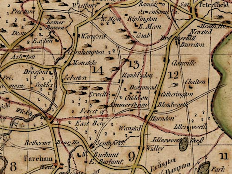
The Hampshire county map issued by John Harrison was first published on 16 December 1788 and later included in his 1791 atlas of England and Wales. Harrison was a London publisher operating from 115 Newgate Street, and his atlas formed part of the late eighteenth-century expansion of commercially produced county cartography.

1645 – Joan Blaeu’s Map of Hampshire

1645 – Joan Blaeu

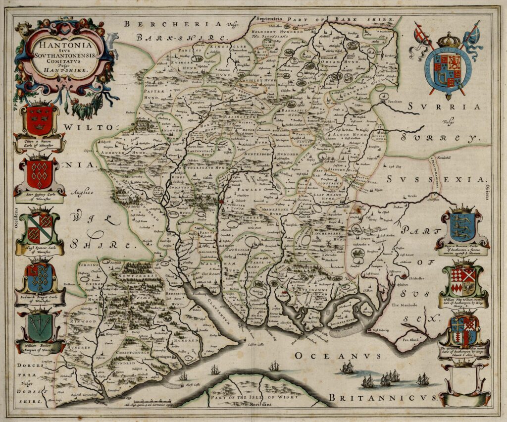
The 1645 engraved map of Hampshire was published by Joan Blaeu (1596–1673), often anglicised as John Blaeu, the Dutch cartographer and atlas publisher based in Amsterdam. Although English sources frequently refer to him as John Blaeu, his correct Dutch name was Joan Blaeu. He was the son of Willem Janszoon Blaeu, founder of the Blaeu cartographic publishing house, and assumed control of the firm following his father’s death in 1638.

1579 – Christopher Saxton

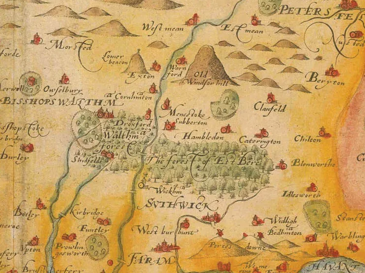
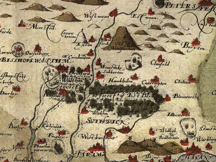
Christopher Saxton’s map of Hampshire, titled Southamtoniae, was engraved around 1575 as part of his systematic survey of England and Wales. The copperplate for the county was prepared during the main production phase of the atlas (c. 1574–1578), with engraving undertaken by Leonard Terwoort of Antwerp. At this stage, the map existed as an individual printed sheet.

1575 – Christopher Saxton

Christopher Saxton, born around 1540 and believed to have originated from Yorkshire, stands as one of the most significant figures in the history of English cartography. Working during the reign of Elizabeth I, he became the creator of the first printed atlas devoted entirely to the counties of England and Wales. His work marked a decisive transition from medieval mapping traditions toward a more systematic, survey-based representation of the landscape.

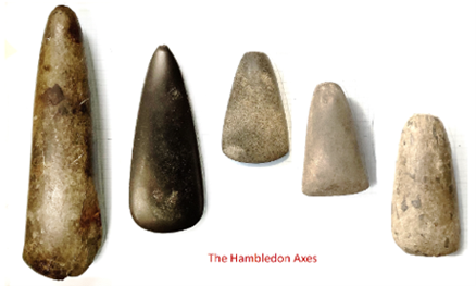
Neolithic Hambledon Axe Heads

5000 BC – 2200BC

Although we have no direct archaeological evidence of settlement in the form of dwellings in Hambledon itself, the surrounding downland and farm fields have a lot of evidence of human activity in the form of flint arrowheads and other flint tools. A burial site was also discovered in the 1990s complete with an antler digging tool and this points toward settlement. We don’t have a record of the exact location though the finds were identified by Winchester Museum Services as grave goods and dated as around 750 BCE.

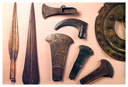
Bronze Age tools

2200 BC – 1200 BC

The development of more sophisticated metal tools in this era changed man’s relationship with the environment – permitting greater control over the landscape and enabling more permanent settlement and effective hunting and defence. During this period permanent field systems appeared and the trading of high value goods took place over considerable distance and some extraordinary craftsmanship has been preserved in archaeological finds. There is not much that Hambledon tells us of this era but in context it is likely that Hambledon provided a location with all the requirements of Bronze Age settlement. The characteristic round barrows dotted around the outskirts of the village are the most visible remnants of this era.

0
0
Your Cart
Your cart is emptyReturn to Shop
Scroll to Top