
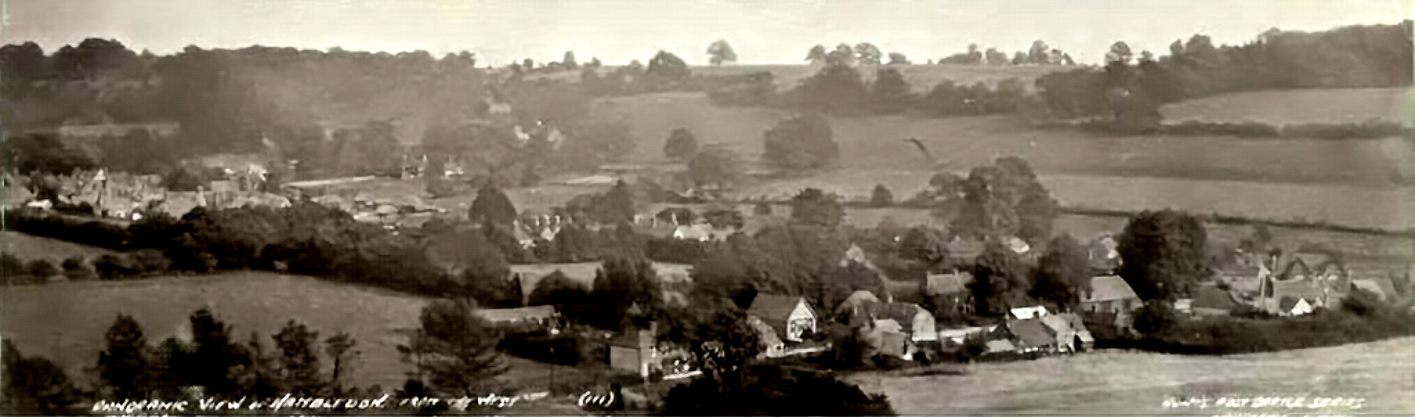
View East Across Green Lane from Headstone Copse
A wide view east across Green Lane and the village centre from Headstone Copse towards Speltham Hill. The Terrace and Methodist Chapel are clearly visible, while the old windmill at the top of Speltham Hill appears in outline on the horizon. The field in the left foreground would later provide the site for Stewarts Green.
Click image to enlarge
Historical Information
This photograph records Hambledon’s landscape before the later twentieth-century development of Stewarts Green. The Terrace and Methodist Chapel are visible in the view, with the old windmill at the top of Speltham Hill on the horizon. The field in the left foreground would subsequently provide the site for Stewarts Green.
The image also illustrates the rural setting of Green Lane at this date. The road is shortly crossed by the Wayfarers Walk, which descends steeply from Litheys Hanger and runs east through Stewarts Green towards the churchyard and beyond. Green Lane continues north with Litheys Hanger to the west and a mixture of housing and farmland before reaching Three Corners, where the route turns towards Chidden and crosses Brook Lane.
The photograph is particularly valuable because it captures the open field landscape immediately before a later phase of village housing development.