street-by-street

Bury Lodge Lane

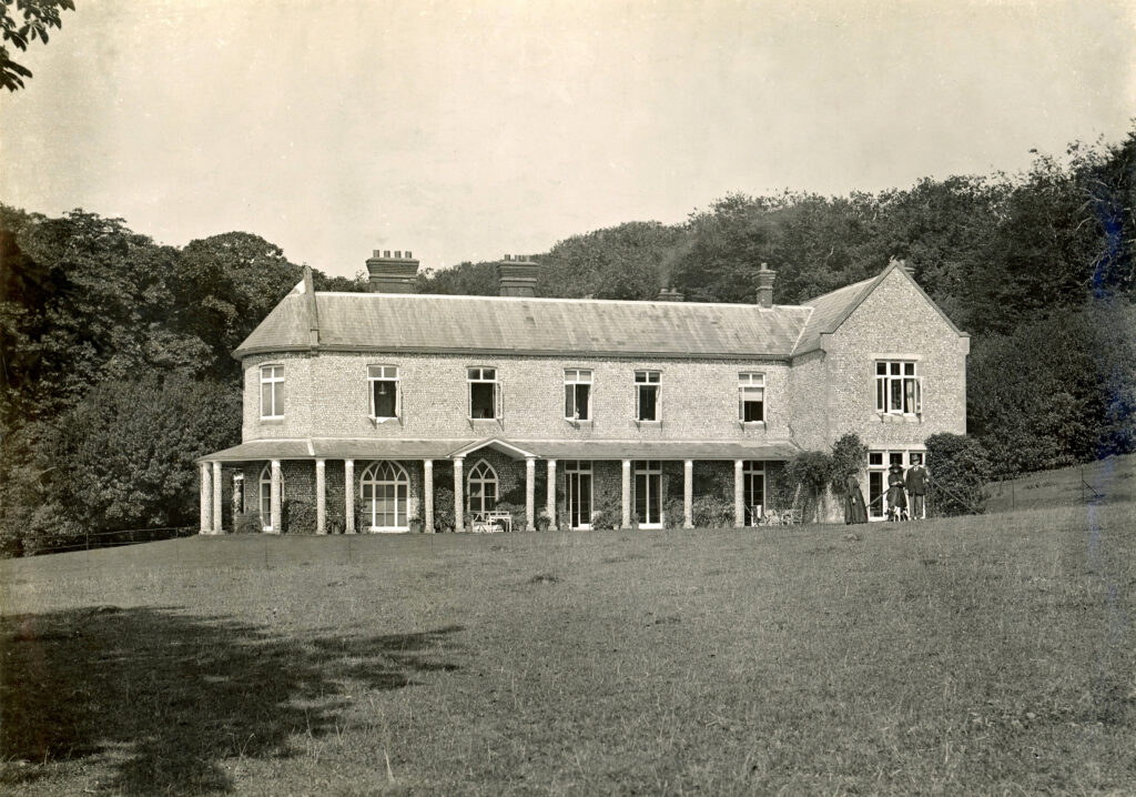
Bury Lodge and its Lane account for a very large chunk of Hambledon’s history. In the grounds of the house that gives the Lane its name are the remains of a Roman villa while in World War II the grounds of this same house accommodated 1,000 troops and 150 military vehicles which were assembled for D Day’s Normandy landings.

Cams Lane

Towards the most westerly end of West St is the junction with Cams Lane on the corner of which is the popular Old Forge Tea Room. The lane snakes up an increasingly steep incline past cottages on the left and, on the right, the distinctive Jacobean house, simply called Cams, set in a lovely landscape and with a commanding view over the western part of the village.

Speltham Hill

Rising from the junction of High Street, East Street and West Street, this road is wide initially but then narrows to a single vehicle width as it turns sharp left to ascend the steep slope of the down. One of the most picturesque lanes in the village, it needs our imagination to grasp its original layout: In the late 1700s the old Market Hall was still standing where the People’s Market is today though in such a dilapidated state that it collapsed in 1818 and all of its rubble removed by 1819.

East Street

East Street, ‘a long straggling road’ in the words of Dora Goldsmith in 1908, runs from High Street as far as Park House and onwards to The Bat & Ball Public House which sits adjacent to Broadhalfpenny Down at the Parish Boundary with Clanfield. Although it is now now residential within the village boundary, East St has, in the past, encompassed every sort of house, business, profession and trade.

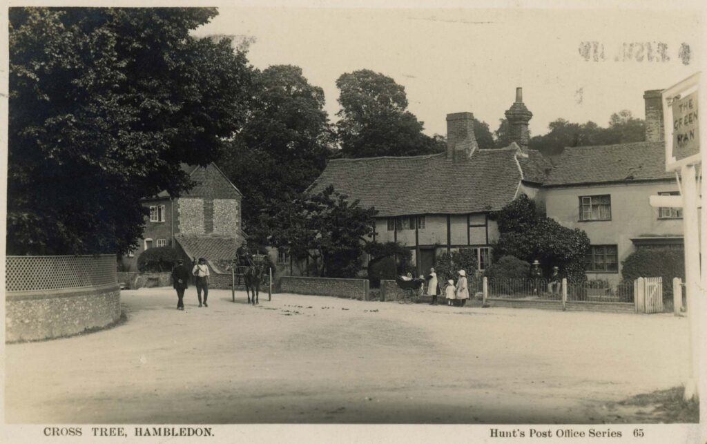
The Green Man junction of Green Lane and West Street, Hambledon, looking east, c.1910

Green Lane

Green Lane, classified B2150, heads north northwest from its junction with West Street. The junction seems to have its own strategic or arterial importance with the siting of The Green Man public house (now a private residence) on the west side and next to it (actually on West St) The Cross Tree, once two attached cottages and now a single residence. Between these adjacent buildings a well-used footpath runs due west up to Boarhuts Copse. On the east side of the junction is a short lane, Crossways – location of two cottages. B2150 is the relatively busy connection with routes to Winchester and Alton. At Three Corners, Green Lane forks right from the main road in the direction of Chidden while the B2150 winds, with spectacular views over downland, past the site of the former Hambledon Race Course, ultimately to intersect with the A32 at Brockbridge.

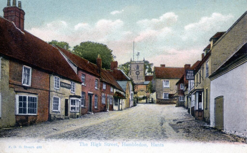
Historic view of High Street, Hambledon looking north towards the Church of St Peter & St Paul

High Street

High Street is an iconic feature of Hambledon and runs north northwest from its junction with East Street, West Street and Speltham Hill. Looking north is an open view through the gate to the Church of St Peter & St Paul with its commanding bell tower.

West Street

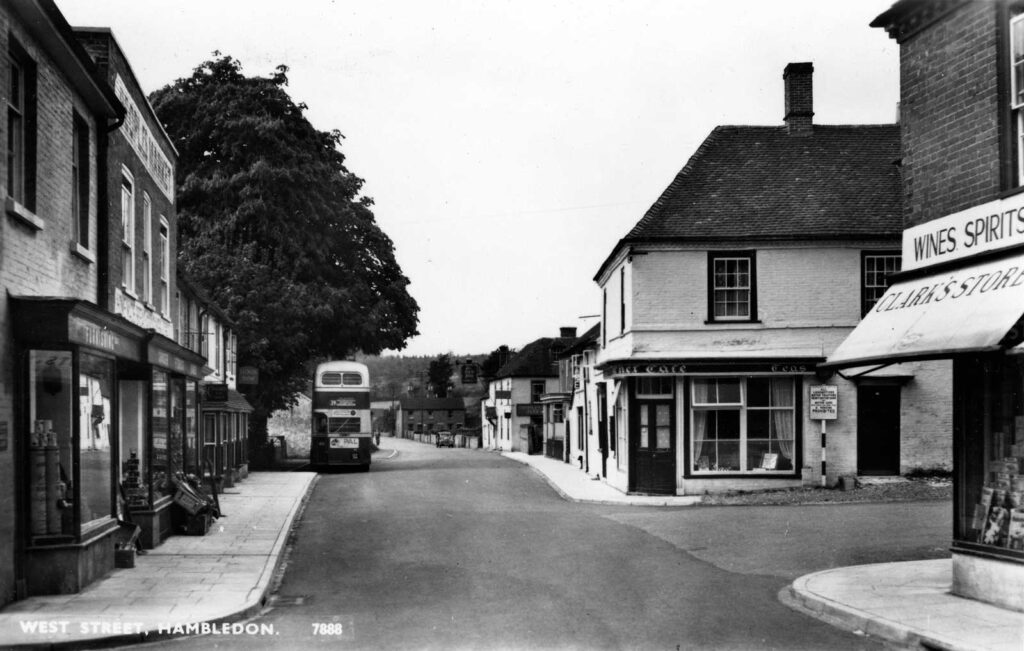
West Street begins at the junction with High Street and runs westward becoming part of B2150 at the Green Man junction, continuing beyond the Village boundary and the junction with Fareham Road towards Denmead via Well Hill. Confusingly West St is bisected at the junction with Green Lane where the latter has right of way giving the impression when travelling west from the village centre that one is joining a different road. To reduce confusion we do talk about Upper West Street (being the easterly section) and Lower West Street the westerly section.

Church Lane looking southeast viewed from the school driveway. The entrance to the churchyard is to the right.

Church Lane

Church Lane branches right from the top of High St at a 90 degree junction; the cottages that range either side of the narrow lane present a village view that is archetypally English, aided by the houses lining the road, scrupulously maintained today by their owners. As the lane turns left there is the entrance to Folly House named for the prominently visible tower overlooking the village whose grounds in the Edwardian era hosted the Old Folly Tea Rooms. The lane leads on past the east gate to the churchyard and on to the Hambledon village school.

Upper West Street

West Street begins at the junction with High Street and runs westward becoming the B2150 at the Green Man junction, continuing beyond the Village boundary and the junction with Fareham Road towards Denmead via Well Hill. Confusingly, West St is bisected at the junction with Green Lane where the latter has right of way, giving the impression when travelling west from the village centre that one is joining a different road. To reduce confusion we do talk about Upper West Street (being the easterly section) and Lower West Street the westerly section.

Lower West Street

At the beginning of Lower West St, to the left on the south side is a pair of Edwardian mock tudor semi-detached homes, Downings and St Davids. In the 1930s the plot of land west of St Davids was still a vegetable garden but is now occupied by two generous sized semi-detached family homes built in the 1970s.

0
0
Your Cart
Your cart is emptyReturn to Shop
Scroll to Top